Geomatics Engineering Technology
Southern Alberta Institute of Technology - SAIT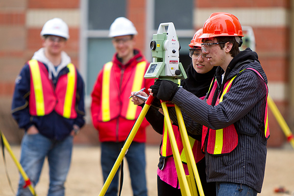
Course Info
The Geomatics Engineering Technology program will provide you with extensive practical skills combined with a broad theoretical background to acquire tools and techniques used in land surveying, remote sensing, cartography, geographic information systems (GIS), global navigation satellite systems (GPS), photogrammetry, geography and digital mapping.
To succeed in the program, you will need to be comfortable with mathematics and enjoy working with computers and instrumentation. In addition, you must be a good team player, have good communication skills, and enjoy working outdoors.
Is this the right fit for me?
Students who enjoy mathematics, are comfortable using computers and instrumentation will experience more success in this program. Additionally, the ideal candidates are methodical and pay attention to detail, have good work ethics and communication skills. Successful students can think visually about geometric forms and can appreciate details in drawings and objects.
Contact time with instructors in lectures and labs is about thirty hours per week. The average student is expected to spend about an additional 25 hours per week on assignments, studying, and projects.
A career in Geomatics Engineering Technology typically includes both office and fieldwork. Depending on a student’s particular career path the proportion of office and field exposure can vary significantly. In the GNT program, students are exposed to fieldwork that simulates field activities.
Additionally, the ideal candidates are methodical and pay attention to detail, have good work ethic and communication skills. GNT graduates will often work in teams of various sizes. In the GNT program, many courses require working in teams for projects or lab assignments. This requires good communication and interpersonal skills.
Accreditation
This program is nationally accredited, at the technologist level, by Technology Accreditation Canada. Graduates are eligible for certification by the Alberta Society of Surveying and Mapping Technologies (ASSMT) and the Association of Science and Engineering Technology Professionals in Alberta (ASET).
Credentials
After successfully completing this program, graduates will be awarded a SAIT diploma in Geomatics Engineering Technology.
Graduates may pursue job opportunities in land surveying, mapping, energy exploration and production, civil engineering and construction, geographic information systems (GIS), mining and natural resources and all levels of government.
Potential positions include:
surveyor
mapping technologist
Related careers include:
geomatics engineer
engineering design and drafting technologist
Diploma
Based on course availibility
Open
January, May, September
Grade 12th English 50% required. Grade 12th Mathematics 50% required. 50% in Grade12th Physics.
IELTS: Overall 6.0 band no less than 6.0 band TOFEL: PTE: N/A
2 Years
CAD$ 20312.90
*Price shown is for indicative purpose, please check with institution
SAIT takes conditional applications on the basis of IELTS Date Confirmation & Last Academic Pending Marksheet
Calgary
Here are some scholarship that are available at The Southern Alberta Institute of Technology - SAIT.
Combined Adrienne Marshall English Scholarship and Barry Marshall Science Scholarship
Tuition Fee Scholarship
For further details, please contact the university website.
- Be students at the Beijing Huija Private School;
- meet all entry requirements normally applied to the English Language Bridging course and the Bachelor of Science1 course;
- not be Australian citizens or permanent residents of Australia; and
- be liable for international full fees.
All international